Batukaru Mt 2200m asl, my first time to hike (9 January 2013)
I moved to Bali (since November 2012) and stay with my boyfriend (Russian) in Penebel, North Tabanan. Every good weather i can see 3 hills in the north side, Batukaru is the highest one.
View from Jatiluwih (17 November 2012)
One of my friend tried to hike few weeks ago, he is a runner. He said it's easy and need 4 hours to go up and down for him. It can be around 4 hours to go up for me, maybe.. I never hike any mountain before, but i really want to try. The problem is, i scared to try alone, and my boyfriend lazy to do it. If he want to do it, he already do it long time ago because he stay here more than 1 year.
One day, his friend from Russia come to Bali. Igor is a strong guy, he did hike many mountains, including Kerinci 3.800m asl (highest Mt of Sumatra island), Semeru 3.676m asl (highest Mt of Java island), Agung 3.142m asl (highest Mt of Bali island), Rinjani 3.726m asl (highest Mt of Lombok island), Trikora 4.750m asl (2nd highest Mt of Papua) and one more in Sulawesi or Maluku, i cannot remember. But the highest mountain he have been is about 7 thousands meters above sea level, and i just open my mouth when he tell me about that. :0
So..Batukaru will be very easy for him, 2200 is not hiking, just trekking. But for me, i don't know, i want to know how strong i am. After barbecue at night, we sleep and wake up around 5 am. Eat some bread with jam, washing face and go. Igor is a good hiker and traveler, but he is not a good motorbike driver. We start at 6 am, go to the temple where we can leave motorbike and start to trekking.
Where to Start?
There are 3 point to start hike Batukaru Mt., first from Batukaru temple, but people will asked money and offering guide (especially if u are foreigner). Second from Pupuan, I'm not sure but wanna try this one later. Third from Jatiluwih (famous with rice terrace), start from a beautiful temple called Bhujangga Waisnawa. We choose the last one, because I've been in this temple at November 2012. From Jatiluwih can ask people how to find this temple, located in Gunung Sari village. There are 3 temple in this location, first is Pura Luhur Pucak Petali.
Pura Luhur Pucak Petali (17 November 2012)
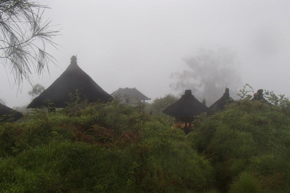
From this temple, take the road in left side and going up about 200meters, and then the second temple is Bhujangga Waisnawa, where we can start to hike and leave car/motorbike here. The parking area is big enough.
Pura Luhur Bhujangga Waisnawa Gunung Sari (17 November 2012)
Pura Luhur Bhujangga Waisnawa Gunung Sari (17 November 2012)
From here, i leave motorbike and start to walking. Take the right road, this road is possible for motorbike, but no parking area at the last temple. From the last temple take left road, and come into garden, I'm not sure but we keep walking until enter the jungle with different vegetation.
Start hiking at 6:48 am
Few meters after that, we saw a sign, yeah this is the real start point. This sign said that we are at 900m asl, that means need to go up 1300 meters to reach the top of this mountain. "Just 1,3 km?", It's the first sentence who come from my mind. But going up is not as easy as walking on the flat road. So how far is the route? Let's see..
Start Point to hike Batukaru Mt (Pic by Igor)
About 300 meters first is almost flat, easy road. And then became high and need to go up, and up, and up. I never did sport, so this road is hard for me, i need to rest and drink water many times. But, every time i take rest to drink and breath, I'm also saw leeches on my feet. LEECH? Yeah, this is forest with big trees, not many sunlight go inside, so the ground is wet in rainy season. Actually i didn't feel it, but I'm scared of them (I'm scare of blood :P). So i always panic when they come and asked Igor to take it many times. We also talking a lot, it's help me to not thinking about how hard the road.
It's rainy season, almost everyday rain, likewise here. But Igor said, when rain we don't need to be sweating, so it's good point. But when we go higher, wind blew stronger, wet and cold.
Rain and windy (Pic by Igor)
It was so cold (Pic by Igor)
I need keep moving and do some simple exercise for my hands, it was so cold. Just 200 meters left, different vegetation, no need going up and no leech again. But many grasses with thorn, it was so disgusting my legs and my hair.
Walking inside grasses with some thorn (Pic by Igor)
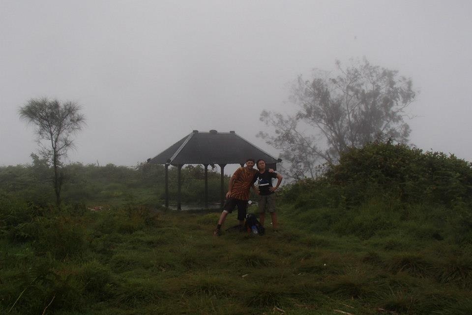
On the top 9:56 am
Finally we reach the top, there is a temple and some area like small camping ground.
Temple on the top of Batukaru Mountain (Pic by Igor)
I did! The first mountain i hike (Pic by Igor)
Perfect partner, instructor and porter
Just two of us on the top, so who took picture? :P
Igor always take video for his blog Sky Tramp, but he said in Russian language :
After take pictures and video, we hide near temple, less wind but still cold. Igor give me his raincoat and i feel little better. We eat some cookies with trembling hands, so funny.
Go down 10:16
Nothing else to do on the top, if we stay longer we can be freeze, so just go down. Few first step, I'm walking very slow and still trembling. But when i feel little warm, i start to walking faster. Igor decided to go first and faster, I'm also try to go faster because scared of leech, scare to be alone and want to comeback home as soon as i can. But after rain, the road became slippery, i fall down many times but i don't care, just run and jump. I seen my foot is bleeding and one leech on the other location, but i try to don't care about that. Take a rest 12:08
We take a rest in a place with beautiful view and little sunny. From here can see the Kuta and Nusa Dua area, not so clear but nice.
I think no leech here, but some leeches still follow me. I take off my sandals and Igor take that leeches, I'm not as scared as before.
Look at my face, still good? I feel better and stronger than when i go up.
But this is the result, dirty!
Here is already more than a half way to comeback, we start to go down again. I'm still feel little far, not hard road but when will we finish it? Finally finish 12:58
When we arrived at the first temple (from forest direction), i check my feet again, and there are 3 leeches here, look at the red circle:
They still follow me until the end of route
After Igor take it all from my foot, they start to looking for blood, again!
3 leeches still hungry (Pic by Igor)
Im also take video of this leeches:
Finish playing with leeches, we go down to the second temple where we parking motorbike and go home.
Bhujangga Waisnawa Temple (Pic by Igor)
After arrived at home, i take shower, cleaning all the soil on my skin. And then i check my feet again, the last places where leeches bite start to bleeding again in few minutes.
Still bleeding after take shower
Igor asked me, "Are u ok?", and i said "Im 100% ok". But the day after that, I'm not ok. My legs feel so painful and not easy to walking. I start to thinking about exercise, so next time i can hike another mountain. This is location of 3 start point to hike Batukaru Mountain :
I'm not sure yet, one of the next few weekends. Let's see how the weather goes. It is raining right now here in Ubud as I write this! I might wait a few weeks until the rains completely stop.
Okay, that is good to know. I think I will wait until May or June for Batukaru then. In the meantime, I might try Mt. Abang. It is closer to where I live and also a shorter hike. I saw you made a post about your trip there as well! I will look at your other posts also. Gives me some nice ideas for more hiking on Bali. Thank you again!
Hi followed your instructions and had very wonderful hike yesterday, cloud forest bliss. Thank you and good for you to make it the whole way to the top, it was hard work!!!


i read your blog and get inspired - thanks.
ReplyDeleteif you like take a look at www.mountains-of-bali.info
chris
This comment has been removed by the author.
ReplyDeleteI was looking for a good description of this hiking route. Thanks, very helpful!
ReplyDeleteMy pleasure!
DeleteWhen are you going to do that route?
I'm not sure yet, one of the next few weekends. Let's see how the weather goes. It is raining right now here in Ubud as I write this! I might wait a few weeks until the rains completely stop.
DeleteYou are right, less leeches and slippery without rain. I did in June and it was amazing view. I could see the mountains surrounding
DeleteOkay, that is good to know. I think I will wait until May or June for Batukaru then. In the meantime, I might try Mt. Abang. It is closer to where I live and also a shorter hike. I saw you made a post about your trip there as well! I will look at your other posts also. Gives me some nice ideas for more hiking on Bali. Thank you again!
DeleteHi followed your instructions and had very wonderful hike yesterday, cloud forest bliss. Thank you and good for you to make it the whole way to the top, it was hard work!!!
ReplyDelete